Date added: 2023-06-13
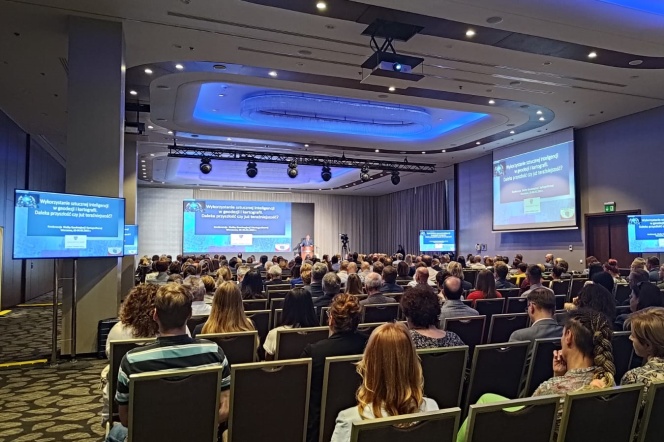
On June 5-6, 2023, the annual conference of the Geodetic and Cartographic Service took place

This year's theme was "The Use of Artificial Intelligence in Geodesy and Cartography: Distant Future or Present?"
News on the website of the Head Office of Geodesy and Cartography (GUGiK)
At the invitation of the Acting Chief Geodesist of the Country, Mrs. Alicja Kulka, Dr. Jakub Szulwic, an academic teacher in our Department of Geodesy at WILiŚ PG, participated in the conference as a member of the State Geodetic and Cartographic Council. The event brought together about 400 people, including Provincial Inspectors of Geodetic and Cartographic Supervision, Provincial Surveyors, County Surveyors, Directors of Regional Offices of Geodesy and Cartography (PODGiK), and their collaborators.
Among the presentations were:
-
"The Use of Machine Learning Methods in GUGiK's Operations" - Dr. Anna Bober, Director of the Department of Geodesy and Geographic Information Systems, GUGiK.
-
"Examples of AI Utilization in Geodesy and Cartography" - Dr. Adam Iwaniak, University of Environmental and Life Sciences in Wrocław.
-
"Challenges of Artificial Intelligence in Geodesy and Cartography" - Karol Stachura, Pomeranian Voivodeship Marshal's Office, also a lecturer in postgraduate studies on "Geographic Information Systems, Geoinformation" at WILiŚ PG.
The first day of the conference focused on the theoretical aspects of implementing artificial intelligence in geodesy and cartography, while the second day showcased the development of these fields in the context of practical solutions. Professor Paweł Hanus from AGH University of Science and Technology delivered a presentation titled "Establishing the Course of Cadastral Parcel Boundaries," which generated a lot of interest. Based on mathematical principles, the professor focused on property-related issues. This event was a significant gathering that brought together geodesy practitioners, administrative representatives, and researchers in the field of geodesy and cartography.
Translation: chatGPT ;-)
The photo comes from an article by GUGiK: https://www.gov.pl/web/gugik/konferencja-sluzby-geodezyjnej-i-kartograficznej


